


Cary Byrd // Founder of CinchLocal
Using Google Maps for Construction: A Contractor's Guide
Why Google Maps is Essential for Modern Contractors

Google Maps for contractors has evolved far beyond simple turn-by-turn directions. In today's competitive construction landscape, smart contractors are leveraging this powerful (and free) platform to streamline project logistics, improve team communication, and dominate local search results.
Quick Answer: How Contractors Can Use Google Maps
- Project Logistics : Create custom maps with laydown areas, access routes, and safety zones
- Team Coordination : Share real-time, interactive plans instead of static PDFs
- Lead Generation : Optimize your Google Business Profile to rank in the local Map Pack
- Service Area Marketing : Showcase completed projects and build local authority
- Mobile Access : Access custom maps on any smartphone for on-site navigation
The construction industry has traditionally relied on static documents - PDFs, printed plans, and hand-drawn sketches that quickly become outdated. As one construction professional noted in a recent case study, "Relying on users to mentally translate static map images onto their phones or satnavs is a waste of time."
Modern contractors need digital marketing strategies that work in real-world conditions. Google Maps bridges the gap between project management and marketing, offering solutions that are both practical for daily operations and powerful for business growth.
I'm Cary Byrd, CEO of CinchLocal, and I've spent over a decade helping contractors leverage digital tools for business growth, including implementing Google Maps for contractors as both a logistics solution and marketing powerhouse. This guide will show you how to transform this familiar tool into your competitive advantage.

Why Ditch Static Plans? The Advantages of Google Maps for Construction Logistics
For too long, construction logistics plans have been stuck in the Stone Age. We've all seen them: the dog-eared PDF, the blurry photo of a whiteboard, or the carefully drawn (but instantly outdated) CAD printout. These "static documents" are like trying to steer a busy construction site with a paper map from 1995. They simply can't keep up!

So, what are the benefits of using Google Maps over these traditional static documents for construction logistics? It boils down to dynamism, accessibility, and sheer intelligence.
- Real-time Updates : Construction sites are fluid environments. A laydown area today might be a crane pad tomorrow. With static PDFs, every change means a new version, a new print, and the inevitable confusion of who has the "latest" plan. Google Maps, especially when using Google My Maps (which we'll dive into shortly), allows for live updates. Change a route, add a new access point, or mark a temporary hazard – and everyone with access sees it instantly. No more "wait, is this the V3 or V4?" headaches!
- Accessibility & Collaboration : PDFs are often emailed, saved to shared drives, or even printed and posted. But what happens when someone needs to access it on-site, on a mobile device, or when they're off-site? Google Maps is cloud-based and accessible from any device with an internet connection. This means your site teams, delivery drivers, and stakeholders can pull up the latest logistics plan on their phones or tablets, right when they need it. This vastly improves communication and collaboration, ensuring everyone is literally on the same page.
- Rich Information & Interactivity
: A PDF is just an image. A Google Map is a living, breathing data canvas. You can embed detailed information directly onto the map:
- Site-specific information sharing : Imagine clicking on an access gate pin and seeing the security guard's contact number, a photo of the gate, and specific entry instructions. Or clicking a laydown area to see what materials are expected there. This kind of rich information sharing is invaluable.
- Interactive elements : Need to know the fastest route from the main road to a specific delivery zone? Google Maps can calculate it in real-time, factoring in traffic. This is something a static document simply cannot do. The ability to route, measure distances, and even get Street View imagery helps everyone better understand the site.
- Version Control (or lack thereof in PDFs) : With PDFs, you're constantly battling version control. Is the team using the most current plan? Did they receive the updated email? With a shared Google My Map, there's only one "live" version. Everyone accesses the same, single source of truth, drastically reducing errors and miscommunication.
- Cost-Effectiveness : While some advanced mapping solutions carry a price tag, the core functionalities of Google Maps and Google My Maps are free. This makes it an incredibly cost-effective solution for contractors of all sizes, allowing even smaller operations to leverage powerful geospatial data.
Let's look at a quick comparison:
| Feature | Static PDF Plans | Dynamic Google Maps |
|---|---|---|
| Updates | Outdated quickly, manual | Live updates, automatic for collaborators |
| Sharing | Hard to share, version issues | Easily shareable via link, always current |
| Interactivity | None | Interactive (routing, measuring, clicking pins) |
| Information | Limited to text/images | Rich data (photos, contacts, notes, links) |
| Accessibility | Device/software dependent | Web-based, mobile-friendly, accessible anywhere |
| Collaboration | Difficult, sequential | Real-time, simultaneous, intuitive |
| Cost | Printing, software licenses | Free for basic use, scalable paid options for APIs |
By adopting dynamic tools like Google Maps, we can see how general contractors can win big with digital marketing. It's not just about efficiency; it's about staying competitive and agile in a demanding industry.
How to Create a Dynamic Construction Logistics Plan with Google My Maps
Ready to transform your construction logistics from chaotic to crystal clear? Google Maps for contractors isn't just about getting from point A to point B – it's about creating a living, breathing command center for your entire project. The secret weapon? Google My Maps, a free tool that most contractors don't even know exists.
Think of Google My Maps as your digital site superintendent. It never sleeps, never forgets important details, and always knows exactly where everything should be. While your competitors are still fumbling with outdated PDF plans, you'll have a dynamic logistics system that updates in real-time and keeps everyone on the same page.
Getting Started: Creating Your First Project Map
Creating your first project map is surprisingly simple, even if you're not particularly tech-savvy. You'll need a Google account to get started – if you don't have one, creating one takes about two minutes and doesn't require a Gmail address.
Head over to Google My Maps and click that big "CREATE A NEW MAP" button. This opens up your blank canvas – think of it as your digital construction site waiting to be mapped out.
The first step is giving your map a clear, descriptive name . Skip generic titles like "Project Map" and go for something specific like "Downtown Office Complex - Phase 1 Logistics." Your future self (and your team) will thank you when you're managing multiple projects and need to find the right map quickly.
Next, search for your project address in the search bar. Google Maps will zoom directly to your construction site, giving you that bird's-eye view you need. Here's a pro tip: switch to satellite view using the "Base map" option at the bottom left. This aerial perspective shows you exactly what's on the ground – existing buildings, access roads, even that annoying tree that might block your crane swing.
Mapping Your Site: Using Layers, Shapes, and Pins
Now comes the fun part – turning that blank map into your project's logistics brain. Google My Maps uses layers to organize different types of information, like transparent sheets you can stack on top of each other. This organizational system is what separates amateur mapmakers from the pros.
Start by renaming your default layer to something meaningful like "Site Zones" or "Access Points." You can create up to 10 layers per map, which is perfect for keeping different information types separate and organized.
Shapes are your best friend for defining areas on your site. Use the polygon tool to outline laydown areas where materials will be stored, mark no-go zones around hazardous areas, and clearly define where your site office and welfare facilities are located. The beauty of digital mapping is in the color coding – make red zones mean "stay out," green areas mean "safe for pedestrians," and blue zones mean "material storage."
Pins handle your specific point locations with surgical precision. Drop pins at every access point and gate, mark exact crane locations (trust me, delivery drivers will love you for this), and pin your first aid stations for safety compliance. Google My Maps offers a variety of custom icons , so you can use a crane symbol for equipment locations and a medical cross for first aid stations.

Adding Critical Details and Routes
Here's where your map transforms from a pretty picture into a powerful logistics tool. Every pin you place can hold a treasure trove of information cards that make your team's life easier.
Click on any pin to open its information card, then start adding the details that matter. Include detailed descriptions of what each area is for, attach photos of specific gates or equipment, and embed contact numbers for key personnel. Imagine a delivery driver clicking on your main gate pin and immediately seeing the security guard's phone number, a photo of the actual gate, and specific entry instructions. That's the kind of site-specific information sharing that prevents costly delays and confusion.
Don't forget to add safety instructions directly to relevant pins. Link to your safety protocols or embed quick reminders right in the map. This integration of safety information directly into your logistics planning helps ensure compliance and reduces incidents.
Drawing delivery routes takes your map to the next level. Use the line tool to trace the exact path trucks should take from the main road to your designated unloading areas. This is particularly valuable for avoiding residential streets during restricted hours or steering around overhead hazards.
The built-in measuring tools let you calculate exact distances between points and determine the area of your marked zones. This data helps with planning material quantities and ensuring you have adequate space for deliveries.
Sharing and Collaborating with Your Team
Your beautifully crafted map is only as good as your team's ability to access and use it. Google My Maps makes sharing incredibly flexible through its share settings . Click the share button and choose between public links (rarely needed for construction logistics) or private access limited to specific team members.
The real power comes in setting the right permissions . Give your project managers "can edit" access so they can update the map as conditions change, while giving subcontractors and delivery drivers "can view" access to the information they need.
Embedding maps into your project management system or company website creates a centralized information hub. Your team can access the live map directly through your existing workflows without switching between multiple platforms.
The seamless mobile access through the standard Google Maps app is where this system really shines. Once you create a map in My Maps, it automatically appears under "Your Places" in the regular Google Maps app on any smartphone. This means your site foreman can pull up the logistics plan, tap on a specific pin, and get turn-by-turn directions – all from the app they already know how to use.
Understanding how to effectively share your digital assets is crucial for modern contractors, and learning about embedding Google Maps as an SEO strategy can provide additional business benefits beyond just logistics management.
This dynamic approach ensures everyone works with current, detailed, interactive information, making your projects run smoother and safer while positioning your company as a forward-thinking operation that accepts modern tools for better results.
Beyond Logistics: Using Google Maps for Contractors to Win More Jobs
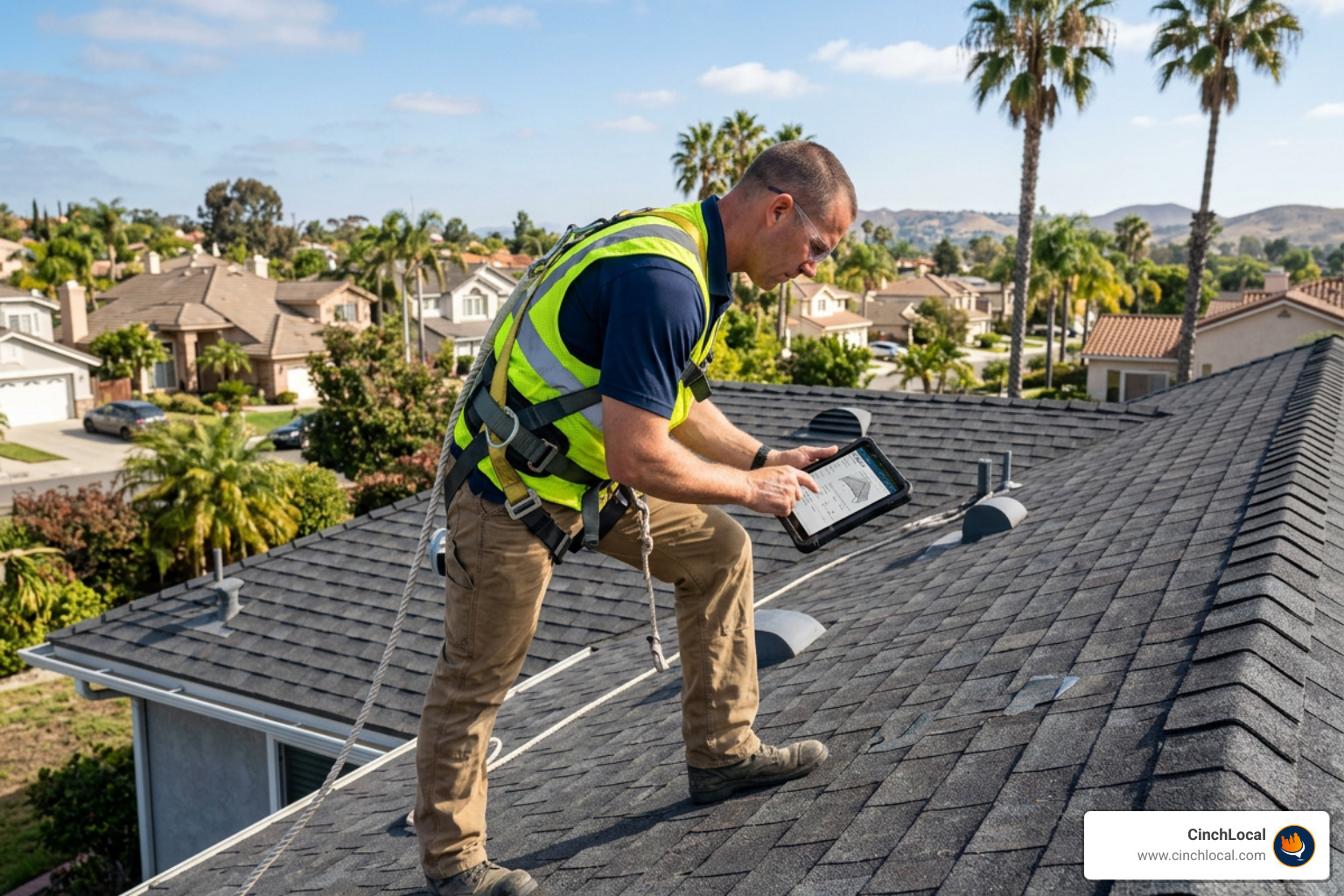
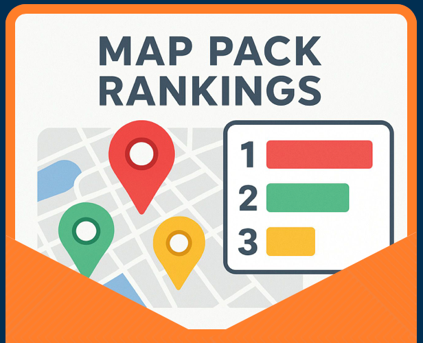
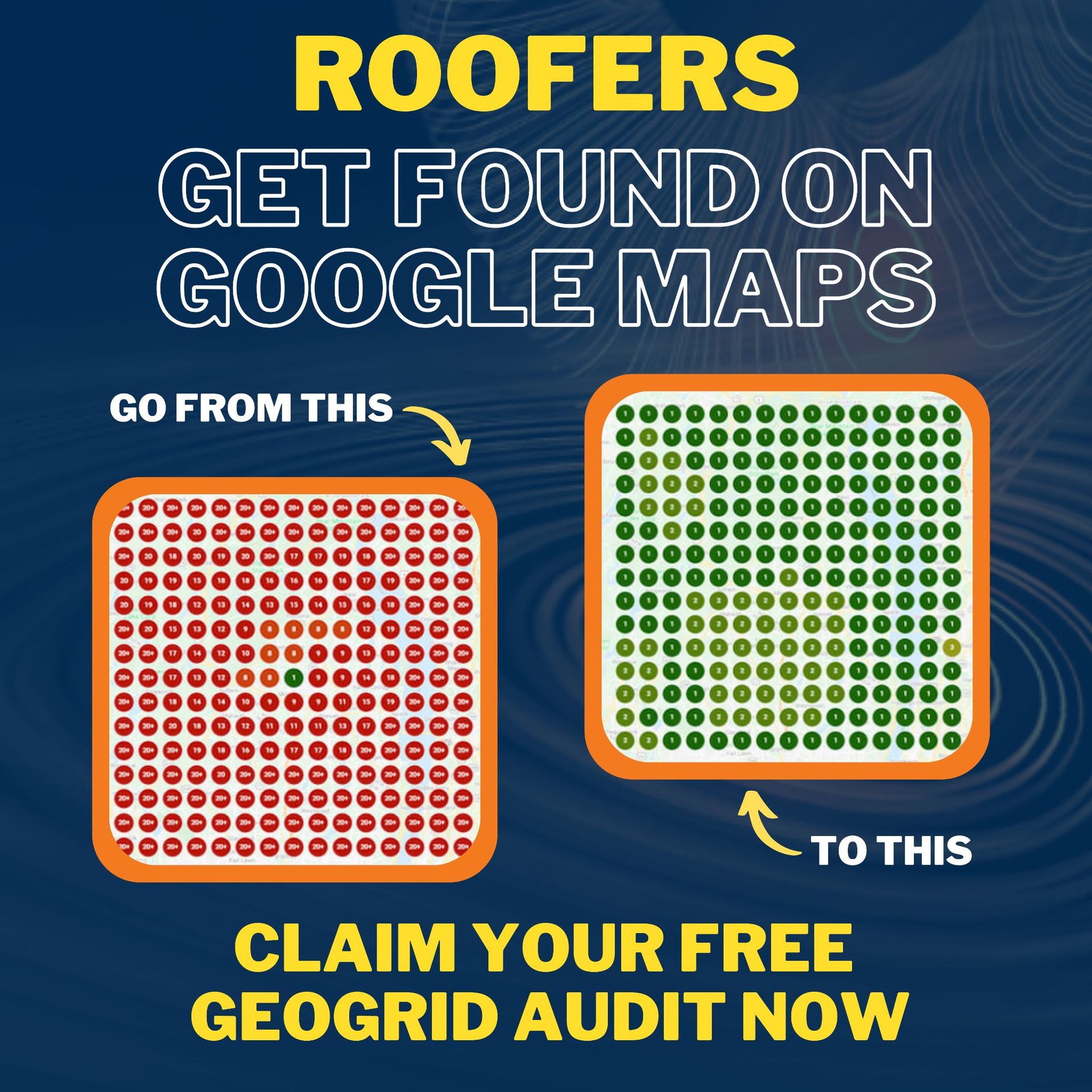
While Google Maps for contractors excels at streamlining project logistics, it's also a powerhouse for winning new business. Think about it: when someone's roof starts leaking at 2 AM, they're not flipping through the Yellow Pages. They're grabbing their phone and searching "emergency roofer near me." And guess what appears first? The Google Map Pack – those three coveted spots that can make or break your lead generation.
The beautiful thing about Google Maps is that it serves a dual purpose. You're already using it for project management, so why not leverage it to dominate your local market too? Smart contractors understand that visibility on Google Maps isn't just nice to have – it's essential for business survival in today's digital landscape.
Optimizing Your Google Business Profile for the Map Pack
Landing in the Google Map Pack (also called the Local 3-Pack) is like having a prime storefront on Main Street, except it's free and reaches everyone in your service area. But here's the catch: Google doesn't just randomly pick three businesses to feature. There's a method to the madness, and understanding it can transform your lead generation.
Your Google Business Profile (GBP) is your golden ticket to Map Pack visibility. First things first – if you haven't claimed and verified your profile, stop everything and do it now. It's free, it takes minutes, and it's the foundation of everything else we'll discuss.
NAP consistency is absolutely critical for ranking success. Your business Name, Address, and Phone number must be identical everywhere they appear online – your website, your GBP, directory listings, everywhere. Even small inconsistencies like "St." versus "Street" can confuse Google's algorithms and hurt your rankings.
Choosing the right contractor categories helps Google understand exactly what services you provide. Don't just pick "General Contractor" if you specialize in roofing. Select "Roofing Contractor" as your primary category, then add secondary categories that match your other services. This precision helps Google match you with the right search queries.
Geotagged photos work like magic for local SEO. Upload high-quality images of your completed projects, your team in action, and your office or truck with your branding visible. Before uploading, geotag these photos with your business location using your phone's camera settings. This sends strong location signals to Google about where you operate.
Customer reviews are pure gold for Map Pack rankings. A business with 100+ positive reviews will almost always outrank one with 20 reviews, even if the smaller business has better ratings. Encourage satisfied customers to leave reviews, and always respond professionally to every review – both positive and negative. This shows Google (and potential customers) that you're actively engaged with your community.
For contractors serious about dominating local search, mastering the Google Map Pack requires a strategic approach that goes beyond the basics.
The Power of Google Maps for Contractors' Marketing
Beyond Map Pack rankings, Google Maps for contractors opens up creative marketing opportunities that most businesses never consider. The key is thinking beyond just "being found" to actually showcasing your expertise and building trust with potential customers.

Showcasing your service areas and completed projects through embedded maps on your website creates powerful visual storytelling. Imagine a homeowner in Columbus seeing pins scattered across Ohio representing beautiful roofing projects you've completed. That visual immediately communicates your experience, reach, and local presence better than any written testimonial could.
Building local authority through consistent Google Maps optimization contributes to your overall digital footprint. When Google sees your business appearing consistently across maps, reviews, and local searches, it builds confidence in your legitimacy as a local service provider. This authority extends beyond maps into general search rankings, creating a compound effect for your online visibility.
Social proof through reviews and ratings displayed prominently on your Map listing influences customer decisions at the moment they're actively searching for contractors. According to BrightLocal's Local Consumer Review Survey, 88% of consumers read reviews to determine the quality of a local business, and positive reviews can increase conversion rates significantly.
Streamlined customer communication through Google Maps features like direct messaging and click-to-call buttons removes friction from the customer journey. When someone finds your business on the map, they can contact you immediately without navigating to your website or writing down your phone number.
At CinchLocal, our specialized Google Maps optimization services help roofing contractors transform their online presence from invisible to unavoidable. We understand that for contractors, Google Maps isn't just about technology – it's about connecting with homeowners in their moment of need and building the trust that converts searches into signed contracts.
Advanced Applications and Alternatives
For contractors looking to scale their operations or integrate mapping into custom software, the Google Maps ecosystem offers powerful, advanced tools that go far beyond what we've covered so far. These solutions are perfect for larger construction firms or those with specific technical needs.
Google Maps Platform APIs for Custom Solutions
Think of Google Maps Platform APIs as the professional-grade toolkit that lets developers build custom mapping solutions directly into your existing software. While Google My Maps is fantastic for day-to-day logistics, these APIs can transform how your entire business operates.
Here's where things get exciting for larger operations. The Route Optimization API can plan the most efficient routes for your entire fleet across multiple job sites, considering real-time traffic and vehicle constraints. Imagine saving hours of drive time and gallons of fuel every week – that's real money back in your pocket.
The Geocoding API converts addresses into precise geographic coordinates, which is incredibly useful for CRM integration or plotting job sites with pinpoint accuracy. Meanwhile, the Places API helps you find detailed information about locations around your job sites – nearby suppliers, gas stations, or emergency services.
For roofing contractors, the Solar API is a game-changer. This tool provides detailed solar energy data for rooftops across 40+ countries and 472 million+ buildings, allowing you to design solar panel arrays and generate proposals without even visiting the site. Talk about efficiency!
The Street View API can embed 360-degree views of job sites directly into your project planning software, giving everyone better context without leaving the office. For massive projects, Imagery Insights and Earth Engine provide geospatial analysis that can help assess terrain, monitor infrastructure, or evaluate environmental factors.
For those with development resources, the Google Maps Platform APIs open up endless possibilities for creating seamless user experiences across web, Android, and iOS platforms.
Cost vs. Benefit: Is Google Maps Free for Contractors?
This question comes up constantly, and the answer depends on what you're using.
Google My Maps – the tool we've focused on throughout this guide – is completely free. You can create custom maps, share them with your team, and access them on mobile devices without spending a dime. For most small to medium-sized contractors, this covers everything they need for logistics and basic marketing.
Google Maps Platform operates on a pay-as-you-go model, but here's the good news: Google offers an incredibly generous free tier. Many common API uses include thousands of free calls per month. For example, you get 10,000 free calls per month for most APIs, and Map Tiles APIs offer up to 100,000 calls at no cost.
This means many contractors find their usage falls within the free limits, effectively making even the advanced features free for their business use cases. When costs do apply for higher usage, they're transparent and usage-based – you only pay for what you actually use.
The benefit-to-cost ratio is typically excellent. Even a 7% reduction in customer support calls (by providing clearer directions to job sites) can easily offset any API costs you might incur.
Other Mapping Tools for Construction
While Google Maps for contractors is our focus today, it's worth acknowledging other mapping solutions exist. GIS platforms like ArcGIS offer incredibly powerful geospatial analysis capabilities, but they come with steep learning curves and significant costs. They're typically used by larger engineering firms for complex environmental assessments or urban planning projects.
Dedicated logistics software often includes built-in mapping features integrated with scheduling, inventory, and fleet management. These can be powerful but usually require substantial investment and training.
Open-source mapping libraries like Mapbox provide extensive customization options for developers who want complete control over map styling and data. However, they require significant technical expertise to implement effectively.
Despite these alternatives, Google Maps remains the best starting point for most contractors. It offers accessibility (everyone knows how to use Google Maps), familiarity (minimal learning curve), cost-effectiveness (free core features), and seamless integration with other Google services like your Google Business Profile.
For contractors just getting started with digital tools, mastering Google Maps provides quick wins with significant returns on minimal investment. These mapping capabilities are a key component of modern SEO for construction companies that won't leave you hammering nails in the dark, helping you stay competitive in an increasingly digital marketplace.
Frequently Asked Questions about Google Maps for Contractors
Can I use a custom Google Map on my phone for navigation?
Absolutely! This is one of the most practical features of Google Maps for contractors . Any map you create in Google My Maps becomes instantly available on your smartphone through the regular Google Maps app. It's surprisingly seamless - just open your Google Maps app, tap on "Your Places" at the bottom, then select "Maps." All your custom construction logistics maps will be right there.
What makes this truly powerful is that you and your entire crew can steer directly to any custom pin you've created. Need to guide a new subcontractor to the exact material laydown area? They can tap your custom pin and get turn-by-turn directions. It eliminates those frustrating phone calls where you're trying to explain "it's behind the blue trailer, near the fence." Your team simply follows their phone's directions to the precise spot you've marked.
Does embedding a Google Map on my website help SEO?
This is a fantastic question that many contractors overlook! Embedding a Google Map on your website is genuinely beneficial for SEO, especially for local businesses like contractors. When you embed a map on your contact page or service area pages, you're sending Google a clear geographic signal about where your business operates.
Think of it as digital proof of your local presence. Google sees the embedded map and says, "Ah, this roofing company really does serve this specific area." This helps verify your location authenticity and can improve your chances of appearing in local search results when potential clients search for "contractors near me."
The user experience benefit is equally important. Visitors can instantly see your service area, get directions to your office, or understand your project locations. This improved engagement sends positive signals to Google about your website's usefulness. It's a simple addition that works double duty - helping both your visitors and your search rankings.
How is Google Maps different from Google Earth for construction planning?
While both tools come from Google's mapping family, they serve very different purposes in construction planning. Understanding when to use each one can save you time and help you choose the right tool for each phase of your project.
Google Maps is your daily operations companion. It excels at 2D logistics, live navigation, and sharing operational plans with your team. This is where you create those interactive project maps we discussed earlier, complete with delivery routes, access points, and safety zones. It's designed for real-time coordination - helping your crew steer to specific locations, avoid traffic, and stay updated on project changes. Think of it as your "boots on the ground" tool for managing day-to-day site activities.
Google Earth , on the other hand, is your 3D visualization and site analysis powerhouse . It's incredibly valuable for the planning phase before construction begins. With Google Earth, you can evaluate terrain and topography to understand elevation changes that might affect your project. You can analyze the surrounding context in three dimensions, seeing how nearby buildings, roads, and landscape features will impact your work.
One of Google Earth's most unique features is historical imagery. You can actually look back in time to see how a site has changed over the years. This is invaluable for renovation projects or when working on properties with unknown site conditions. For larger infrastructure projects, the 3D visualization helps you understand how your new construction will fit into the existing landscape.
Google Maps handles your "right now" needs - getting people and materials where they need to go efficiently. Google Earth handles your "big picture" planning - understanding the site before you break ground and visualizing the completed project in its environment.
Conclusion
Throughout this comprehensive guide, we've finded that Google Maps for contractors has evolved into something far more powerful than a simple navigation tool. It's become an essential business asset that delivers a compelling two-for-one advantage: streamlining your daily operations while simultaneously boosting your marketing efforts.
On the operational side, we've seen how Google Maps transforms chaotic construction logistics into smooth, coordinated efforts. No more outdated PDF plans or confusing paper sketches. Instead, you get dynamic, interactive maps that keep your entire team synchronized, whether they're managing deliveries, coordinating equipment placement, or navigating safety protocols. The real-time updates and mobile accessibility mean everyone stays on the same page, literally.
But the marketing benefits are equally impressive. When you optimize your Google Business Profile and leverage the platform's local search capabilities, you're positioning your business exactly where potential customers are looking. The Google Map Pack visibility we discussed isn't just about appearing in search results – it's about capturing those high-intent leads who are ready to hire a contractor right now.
The beauty of this approach lies in its accessibility. Whether you're a solo contractor just starting out or running a large operation with multiple crews, Google Maps scales with your needs. The core features through Google My Maps are completely free, and even the advanced API capabilities come with generous free tiers that work for most businesses.
At CinchLocal, we've helped countless roofing contractors harness these exact strategies to dominate their local markets. We understand that effective digital marketing for contractors requires tools that work in the real world, not just in theory. Google Maps fits that bill perfectly.
Creating a solid blueprint to online visibility starts with mastering accessible tools like Google Maps. When you combine smart logistics planning with strategic local marketing, you're not just running a more efficient business – you're building a more profitable one.
The next time you pull up Google Maps to find a job site, remember: you're holding a powerful business growth tool in your hands. Use it wisely, and watch your efficiency and lead generation soar.
Want Us to Uncover Hidden 'Footprint Gaps' And Critical Blind Spots That’s Quietly Draining Calls, Jobs, and Profits?
Simply Fill Out The Form Below:
What If You Could Stop Wasting $30K+ a Year on Dead-End Marketing - And Finally Become the Go-To Roofer in Your City?
Other Helpful Articles You Might Enjoy