


Cary Byrd // Founder of CinchLocal
Why Roofing Contractors Are Using Google Maps to Measure Roofs Remotely
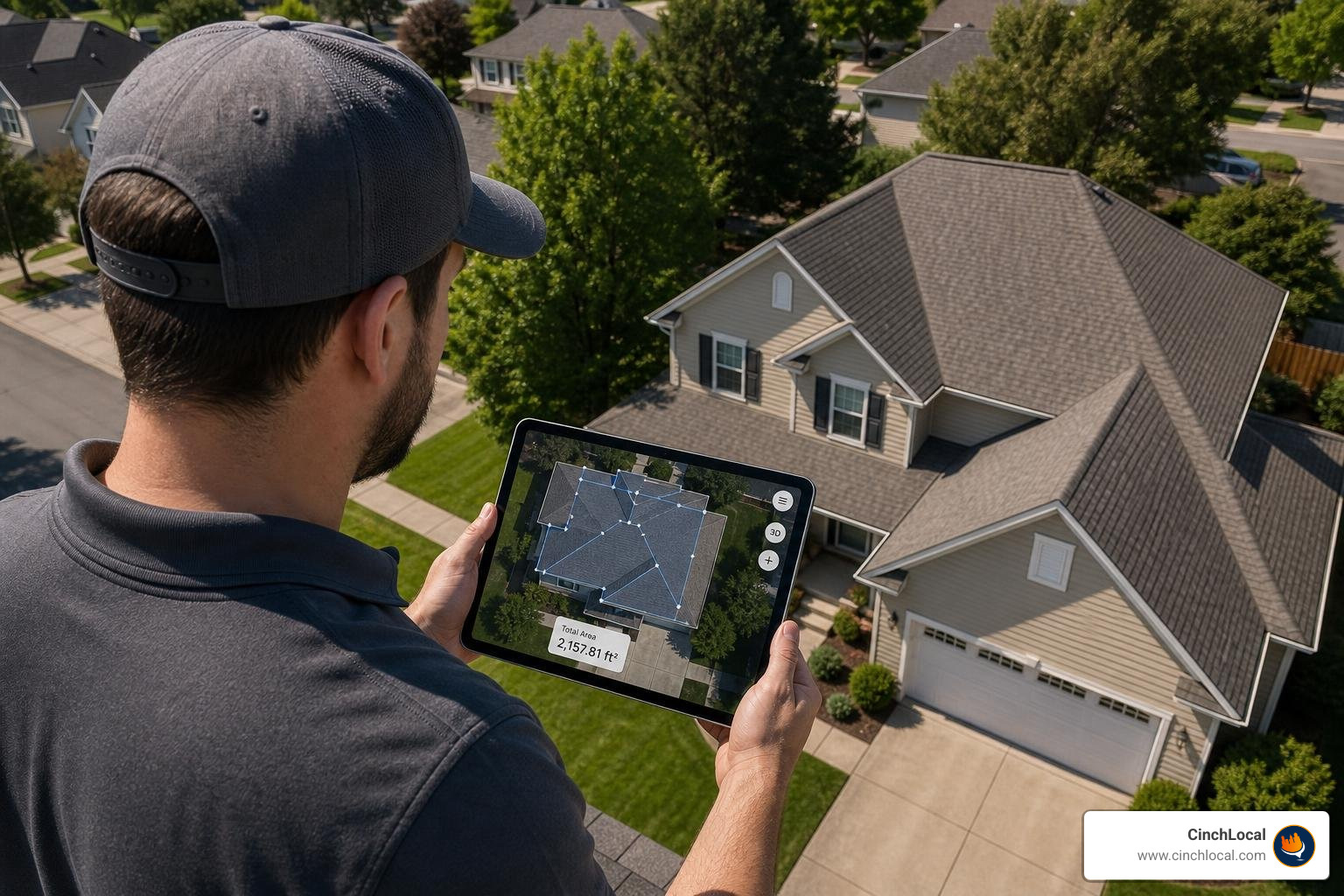
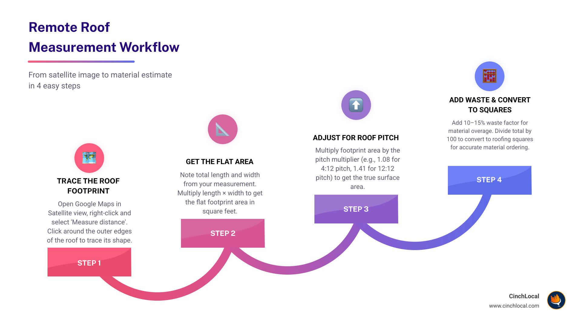
Here's the quick answer on how to calculate roof square footage Google Maps :
- Open Google Maps and switch to Satellite view
- Right-click your starting corner and select "Measure distance"
- Click around the roof's outer edges (corners only — avoid the ridge) to trace the footprint
- Note the total length and width measurements
- Multiply length × width to get the flat footprint area (in sq ft)
- Multiply that number by your pitch multiplier (e.g., 1.08 for a 4:12 pitch) to get true roof surface area
- Add 10–15% for waste
- Divide by 100 to convert to roofing squares
Every roofing estimate starts with one number: square footage. And for years, getting that number meant either climbing a ladder or paying for a report. But now, satellite tools have changed the game for small and midsize contractors who need fast, free ballpark numbers before committing to a site visit.
The problem? Most tutorials skip the most important step — adjusting for roof pitch . A flat satellite image only shows your roof's footprint , not its actual surface area. A steep 12:12 pitch roof has 41% more surface area than its footprint suggests. That gap can mean ordering hundreds of dollars too few in materials.
This guide fixes that. Whether you're quoting a new client or doing a quick pre-bid check, you'll learn exactly how to go from a satellite image to an accurate, pitch-adjusted square footage number — without leaving your office.
I'm Cary Byrd , CEO of CinchLocal, a roofing marketing agency, and I've spent years helping contractors use digital tools — including how to calculate roof square footage on Google Maps — to win more jobs faster and with less legwork. Let's get into it.
Essential calculate roof square footage google maps terms:
Step-by-Step: How to Calculate Roof Square Footage Google Maps
Measuring a roof remotely is straightforward once you know how to navigate the Google Maps interface. Google Maps linear measurements are typically within 95-98% accuracy for linear dimensions if the image resolution is high. However, to achieve this level of accuracy, you must follow a structured process.
Step 1: Locate the Property in Satellite View
Open Google Maps on your desktop computer. Enter the target property address in the search bar. Once the map loads, click on the Layers icon in the bottom-left corner and select Satellite view. Zoom in as close as possible to the roof while maintaining a clear, unpixelated image.
Step 2: Establish Your Starting Point
Find a corner of the roof where the eaves meet. Right-click on this starting corner and select "Measure distance" from the drop-down menu. This action places your first measurement node on the map.
Step 3: Trace the Roof Perimeter
Continue clicking along the outside edges of the roof to drop additional points. For an accurate footprint calculation, you must only click on corners that sit at the same elevation level. Avoid clicking along the ridge or peak of the roof, as satellite perspective distortion will skew your linear measurements.
Step 4: Complete the Shape and Record the Footprint
Click back on your initial starting node to close the polygon. Google Maps will automatically display the total area in square feet at the bottom of the screen. If you are using a dedicated overlay tool, you can also log these dimensions directly. For more specialized integrations, check out the Google Maps Roofing Measurement Tool | MAPQX to automate this drawing and calculation process.
Using a structured approach ensures you capture the exact horizontal boundaries of the home. This baseline measurement is known as the roof footprint. For a deeper dive into manual tracing, refer to our DIY guide to measuring a roof with Google Maps.
The Math Behind the Map: Footprint vs. Actual Surface Area
A common mistake among contractors is assuming the flat square footage shown on Google Maps equals the actual surface area of the roof. Because satellite imagery is captured from a top-down perspective, it only measures the horizontal plane. This is the roof footprint .
To convert this 2D footprint into the true 3D surface area , you must apply a mathematical factor known as a pitch multiplier . The steeper the slope of the roof, the larger the actual surface area will be compared to its flat footprint. For instance, a 12:12 roof pitch has 41% more surface area than a flat roof with the same footprint.
To calculate the true roof area, use this formula:
$$\text{Actual Roof Area} = (\text{Flat Footprint Area} \times \text{Pitch Multiplier}) + \text{Overhangs}$$
Roof Pitch Multiplier Reference Table
Use this reference table to find the correct multiplier for your calculations:
| Roof Pitch (Rise:Run) | Slope Angle (Degrees) | Pitch Multiplier |
|---|---|---|
| Flat (0:12) | 0° | 1.000 |
| Low (3:12) | 14.0° | 1.031 |
| Medium (4:12) | 18.4° | 1.054 |
| Medium (6:12) | 26.6° | 1.118 |
| Steep (8:12) | 33.7° | 1.202 |
| Very Steep (12:12) | 45.0° | 1.414 |
If you are dealing with a standard suburban home of 1,500 square feet with a 4:12 pitch, your base footprint is 1,500 sq ft. Multiplying this by the 1.054 pitch multiplier yields a true surface area of approximately 1,581 square feet. For more complex slopes, utilizing a Roof Area Calculator Using Google Maps – Calculator City can help prevent manual math errors.
To understand how to navigate these calculations using alternative 3D maps, read our Google Earth roof area calculator guide.
Advanced Remote Estimation: Google Earth vs. Google Maps
While standard Google Maps is excellent for quick linear measurements, Google Earth Pro offers a more advanced toolkit for professional roofing estimates.
Google Earth Pro is a downloadable desktop application that provides high-resolution 3D imagery and advanced polygon drawing tools. Unlike the web-based Google Maps, which primarily measures flat distances, Google Earth Pro allows you to tilt, rotate, and view historical imagery of a property. This makes it easier to spot architectural details like hidden valleys, dormers, and chimney structures.
Key Differences for Roofing Estimators:
- Google Maps : Best for rapid, on-the-go footprint measurements. It uses a flat 2D projection and is highly accessible but lacks advanced 3D manipulation.
- Google Earth Pro : Features a dedicated Polygon Tool that directly calculates the area and perimeter of a 3D shape. It also includes tilt controls to help you visualize the roof pitch from oblique angles.
When using either tool, camera tilt can introduce perspective errors. Satellite images are frequently captured at slight angles rather than a perfect top-down nadir view. To minimize errors, always zoom in as close as possible and look directly from above for the top shot.
For a complete breakdown of how to use these platforms like a professional, check out our Google Maps roof size calculator tips. Additionally, you can learn more about the math behind these platforms on Calculate Square Footage Using Google Maps – Calculator City.
Limitations and Accuracy of Satellite Roof Measurements
While remote estimation tools save time, they are not a complete substitute for a physical site inspection. Relying solely on satellite images can lead to costly material shortages if you do not account for real-world obstructions.
1. Tree Coverage and Obstructions
Heavy foliage can completely block your view of a roof. In industry studies of aerial measurement accuracy, traditional remote measurements had an 8% failure rate due to tree coverage, requiring contractors to perform manual on-site measurements. If tree limbs block the eaves, your Google Maps measurements will be based on guesswork.
2. Image Resolution and Oblique Angles
Satellite imagery is updated less frequently in rural areas compared to major urban centers. Outdated or low-resolution images make it difficult to locate exact roof corners. Furthermore, satellite cameras often capture images at a slight angle, which distorts the 2D flat projection of a sloped roof.
3. Verification Best Practices
Before ordering materials or signing a binding contract, always perform an on-site verification. Check for localized issues such as wood rot, multiple shingle layers that need to be torn off, and the condition of the roof decking.
To learn more about maximizing your accuracy when using digital maps, read our definitive guide to Google Maps for roofing. For tips on identifying structural details from aerial views, see Roof Dimensions Google Maps – AerialTakeoff.com.
Need to scale your roofing business without spending hours on manual estimates? Let CinchLocal help you attract high-intent local leads automatically. Visit CinchLocal today to learn how we help home service businesses dominate their local markets.
Frequently Asked Questions About Remote Roof Calculations
Can I reliably calculate roof square footage google maps for complex roofs?
Yes, but you must change your approach. Do not try to trace a complex, multi-section hip or gable roof as a single shape. Instead, break the roof down into smaller, simpler geometric sections (rectangles and triangles). Measure each section individually on Google Maps, apply the correct pitch multiplier for each facet, and sum the totals. For an automated solution that helps trace complex facets with AI, you can try the Free Roof Measurement Tool — Satellite Roof Measurements & Reports.
What is the easiest way to calculate roof square footage google maps and convert it to roofing squares?
Once you have calculated your total pitch-adjusted square footage, you must convert it into "roofing squares" (the standard unit of measurement for ordering materials, where 1 square = 100 square feet).
For example, for a 1,500 square foot house with a 4/12 pitch and 1-foot overhangs, you will need approximately 19 squares of materials. Since standard 3-tab shingles are sold in bundles (with 3 bundles making up 1 square), this project would require 57 bundles of shingles. Always add a 10% to 15% waste factor to your total square footage before ordering to account for cuts, starter strips, and ridge caps. For more tips on using these numbers in your construction pipeline, read our guide on using Google Maps for construction.
How do I find my roof pitch remotely without climbing a ladder?
If you cannot safely climb the roof, you can find the pitch remotely using a few different methods:
- Use a smartphone level app while standing at a distance aligned with the gable end of the house.
- Measure 12 inches horizontally along the gable trim from the ground and measure how many inches it rises vertically (rise over run).
- Check local property records or historical building permits, which often list the original architectural specifications.
Ready to turn your estimates into signed contracts? Don't let manual lead generation slow your growth. Partner with the industry experts at CinchLocal to build a consistent pipeline of pre-qualified roofing leads. Get started with CinchLocal and watch your business scale.
Conclusion
Learning how to calculate roof square footage Google Maps is a game-changer for modern roofing contractors in Ohio, Tennessee, Georgia, and California. It allows you to pre-qualify leads, generate fast ballpark estimates, and save hours of driving time every week.
However, saving time on estimates is only half the battle. To scale your roofing business, you need a steady stream of high-quality leads looking for your services. That is where we come in.
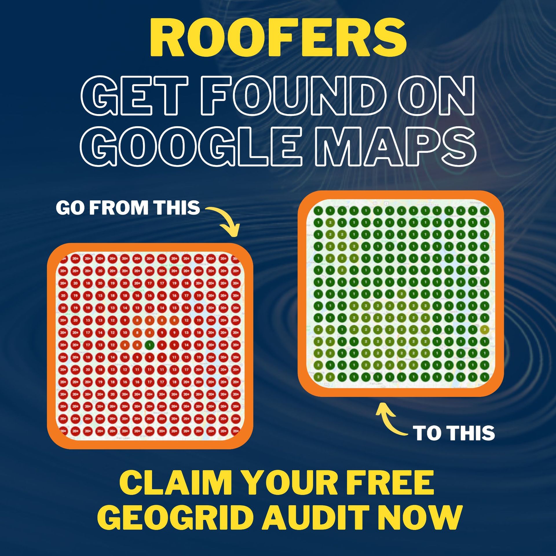
At CinchLocal , we specialize exclusively in digital marketing for the roofing industry. Our proprietary Roofer Footprint Expansion System is designed to dominate local search results, guaranteeing increased Google Maps visibility and pre-sold leads within 30 days.
Ready to turn your local market into a quoting machine? Let us handle your local SEO while you handle the estimates. Explore our Google Maps local SEO for roofers services, and see the proof of our work on our CinchLocal results page. Contact us today to schedule your consultation!
Want Us to Uncover Hidden 'Footprint Gaps' And Critical Blind Spots That’s Quietly Draining Calls, Jobs, and Profits?
Simply Fill Out The Form Below:
What If You Could Stop Wasting $30K+ a Year on Dead-End Marketing - And Finally Become the Go-To Roofer in Your City?
Other Helpful Articles You Might Enjoy