


Cary Byrd // Founder of CinchLocal
How to Measure Google Maps Roof Square Footage Step-by-Step
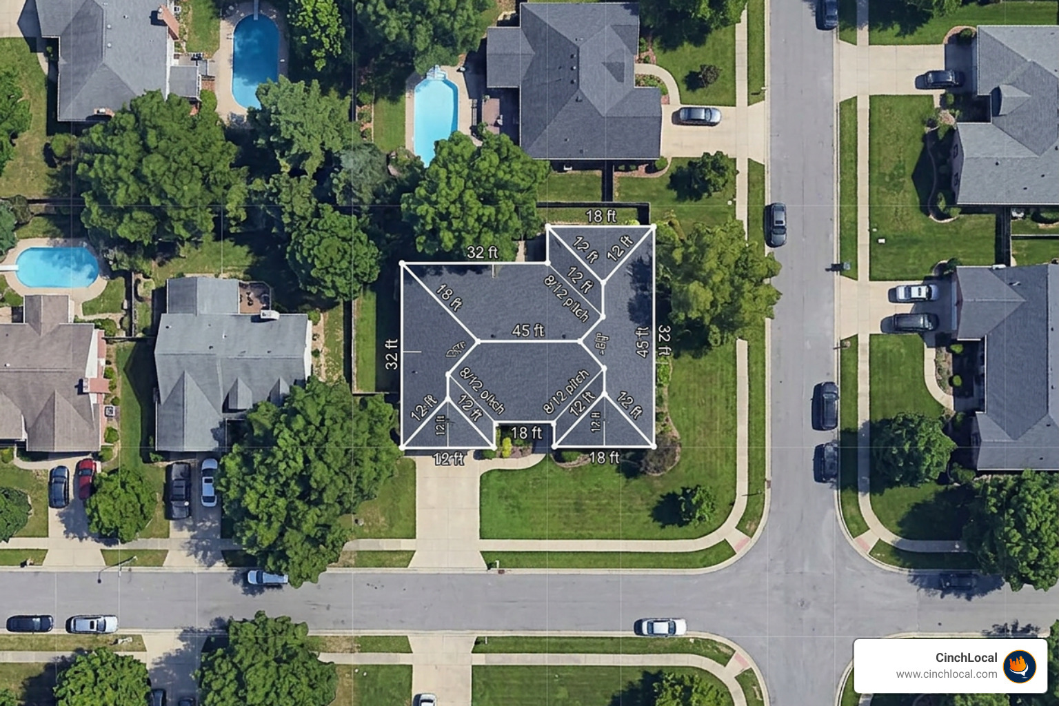
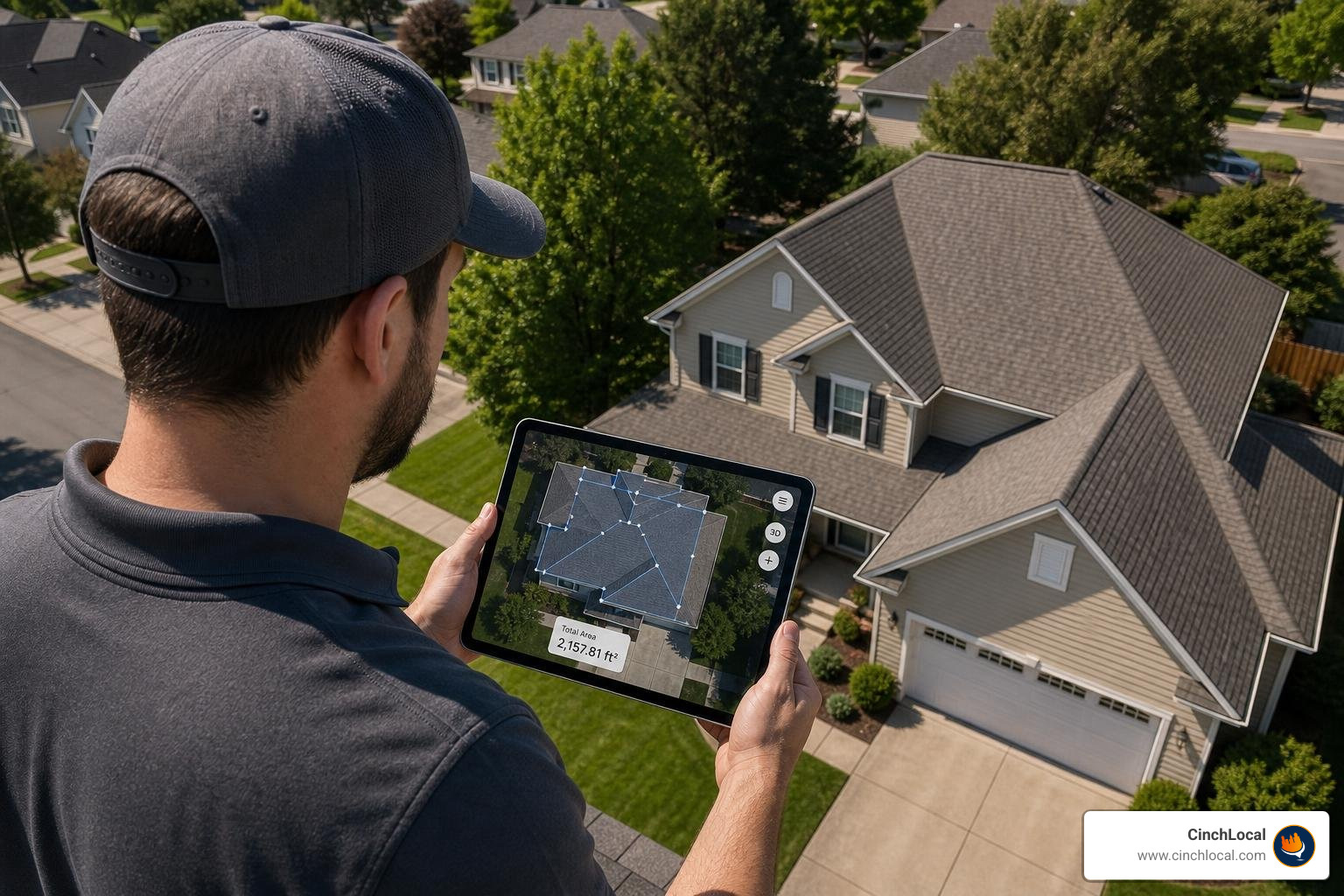
Measuring a roof using aerial imagery requires converting a 2D overhead view into a 3D surface model. Following a structured methodology prevents underestimating material orders or miscalculating project labor. You can follow The DIY Guide to Measuring a Roof with Google Maps or use an online Area Calculator - Outline a property on a google map and find its area to trace property boundaries quickly.
Calculating Base Footprint vs Actual Surface Area
A satellite photograph captures a building's two-dimensional ground footprint projection. Because roof planes slope upward from the eaves to the ridge line, the flat map projection understates the actual surface area.
To determine true surface area:
- Measure the flat 2D footprint (length × width) using aerial tools.
- Identify the pitch (slope) of the roof.
- Multiply the 2D footprint by the correct roof pitch multiplier.
For example, a flat footprint of 2,000 square feet on a home with a 6/12 roof pitch requires a multiplier of 1.22, yielding an actual roof surface area of 2,440 square feet before waste additions.
Step 1: Using native Google Maps roof square footage tools
Native Google Maps includes a built-in linear and perimeter measurement feature that calculates base surface area:

- Navigate to Google Maps on a desktop browser and enter the target property address.
- Switch to Satellite View and zoom in as close as possible while maintaining sharp resolution.
- Position your cursor over an outer eave corner of the roof, right-click, and select Measure distance .
- Left-click along the outer perimeter corners of the roof edges, tracing the full outline of the building footprint.
- Click back on the starting point to close the polygon loop. Google Maps will automatically display the total area in square feet at the bottom of the screen.
Step 2: Applying pitch multipliers to google maps roof square footage
Because flat map measurements reflect a 0:12 slope, you must apply a pitch multiplier to account for the vertical rise.
Use this pitch multiplier table to convert 2D footprint area into 3D roof area:
| Roof Pitch (Rise:Run) | Angle (Degrees) | Slope Multiplier Factor |
|---|---|---|
| Flat (0:12 to 2:12) | 0.0° – 9.5° | 1.00 – 1.03 |
| Low Pitch (3:12 to 4:12) | 14.0° – 18.4° | 1.05 – 1.08 |
| Medium Pitch (5:12 to 6:12) | 22.6° – 26.6° | 1.12 – 1.22 |
| Steep Pitch (7:12 to 9:12) | 30.3° – 36.9° | 1.28 – 1.40 |
| Very Steep Pitch (10:12 to 12:12) | 39.8° – 45.0° | 1.48 – 1.64 |
Formula:
$$\text{Base Footprint Sq. Ft.} \times \text{Pitch Multiplier} = \text{Actual Roof Surface Area}$$
Top Digital Tools for Estimating Roof Square Footage via Google Maps
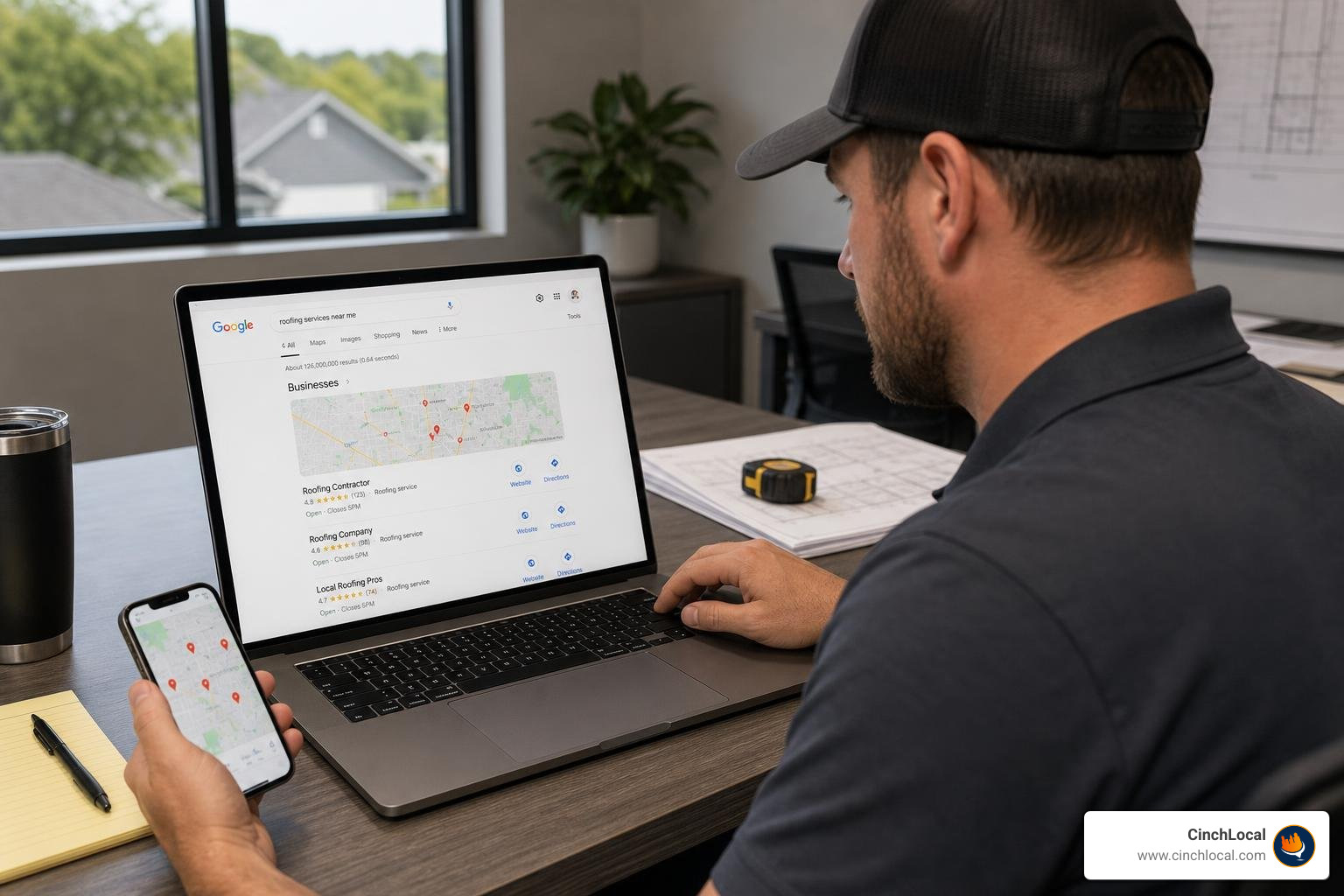
Using the right tool depends on whether you need quick preliminary estimates for client calls or high-speed automation for lead qualification. Here is how the top platforms compare:
| Tool / Platform | Speed | Accuracy | Primary Feature | Best Use Case |
|---|---|---|---|---|
| Native Google Maps | 2–3 mins | 95–98% (Linear) | Free perimeter distance tracing | Quick manual estimations |
| MAPQX Plugin | Instant | 95–98% | Website quote widget integration | Contractor website lead capture |
| Google Solar API | ~10 secs | 95–98% (2-5% error) | Automated 3D building detection | Mass lead pre-qualification |
| Google Earth Pro | 3–5 mins | 96–99% | Historical imagery & 3D tilt | Tracing complex angles & shadows |
For a complete breakdown of leveraging remote mapping software in your business, consult our guide on Using Google Maps for Construction: A Contractor's Guide.
Interactive Website Estimators and Quoting Widgets
Contractors can embed interactive mapping software directly onto their websites to let homeowners self-quote. Software like the Google Maps Roofing Measurement Tool | MAPQX allows prospective clients to draw their roof perimeter on a satellite map, select their slope, and instantly generate an estimated price per square foot.
Integrating map-based estimation widgets converts passive web visitors into pre-qualified leads, shortening sales cycles by establishing clear budget expectations upfront.
Automated Satellite Imagery and API Integration
For contractors handling high lead volumes, manual polygon tracing can be time-consuming. Modern estimating systems leverage the Google Solar API, which has mapped over 472 million buildings in the United States.
Platforms utilizing this data, such as Free Satellite Roof Measurements for Contractors, deliver complete rooftop breakdowns in approximately 10 seconds with 2–5% measurement error. This eliminates per-report fees and speeds up preliminary estimating.
3D Desktop Measurement via Google Earth Pro
When overhead Google Maps imagery is obscured by trees or shadows, Google Earth Pro provides advanced desktop measurement features.
Key advantages of Google Earth Pro include:
- Historical imagery sliders to view properties across different seasons (e.g., winter views without tree leaf cover).
- Perspective camera tilting to inspect gables, dormers, and vertical pitch angles.
- Dedicated polygon area tools that output precise square footage and linear edge lengths in a single step.
Learn more about desktop aerial estimation in The DIY Guide to Using a Google Earth Roof Area Calculator and review specialized techniques on How to Measure a Roof Using Google Earth.
Streamline Your Estimating and Lead Pipeline
Fast satellite estimation tools work best when you have a steady stream of incoming roofing leads. If you want to turn your digital presence into a consistent source of high-margin jobs, CinchLocal can help optimize your online visibility so qualified homeowners reach out directly to your business.
Advanced Pitch, Overhang, and Waste Calculations for Roofing Contractors
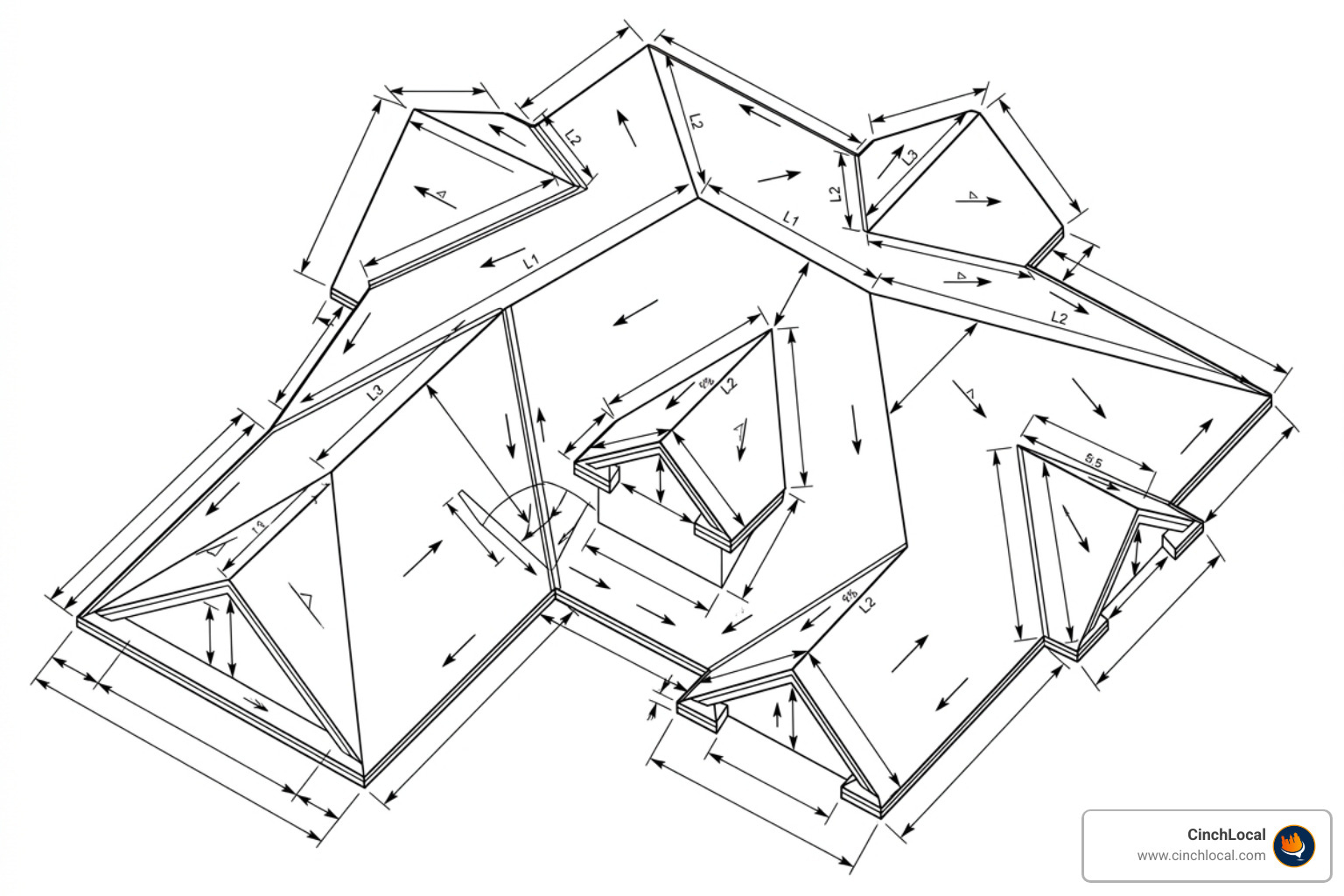
Estimating standard gables is straightforward, but multi-section hip roofs, dormers, and architectural overhangs require advanced structural adjustments. For step-by-step guidance, refer to The Lazy Roofer's Guide to Calculating Roof Square Footage Online and test your calculations with the Roof Area Calculator Using Google Maps – Calculator City.
Handling Complex Multi-Section and L-Shaped Roofs
When measuring complex or L-shaped roofs, do not outline the entire structure as a single complex polygon. Camera perspective angles can distort irregular shapes.
Instead, use the shape decomposition method:
- Divide the complex roof into basic geometric shapes (rectangles, triangles, trapezoids).
- Measure the ground footprint of each section separately.
- Apply the appropriate pitch multiplier to each individual section.
- Add the surface area of all sections together.
Never subtract small roof penetrations like chimneys or skylights from your total square footage. Cutting shingles around penetrations uses extra flashing and material, offsetting any open area.
Converting Square Feet into Roofing Squares and Bundles
In the roofing industry, materials and labor are priced by the "square."
- 1 Roofing Square = 100 square feet of roof surface area.
- 1 Standard Shingle Bundle = 1/3 of a roofing square (covers ~33.3 sq ft).
To determine required material quantities, apply a standard waste factor to account for ridge caps, starter strips, valleys, and cutting cuts:
- Standard Gable Roof: Add 10% waste.
- Complex Hip Roof / High Pitch: Add 15% to 20% waste.
Calculation Example:
For a 2,200 sq ft actual roof area with a 15% waste factor:
- $\text{Total Sq Ft with Waste} = 2,200 \times 1.15 = 2,530\text{ sq ft}$
- $\text{Total Squares} = 2,530 \div 100 = 25.3\text{ Squares (round up to 26)}$
- $\text{Total Shingle Bundles} = 26 \text{ Squares} \times 3 = 78\text{ Bundles}$
Limitations and Accuracy Bottlenecks of Satellite Roof Measuring
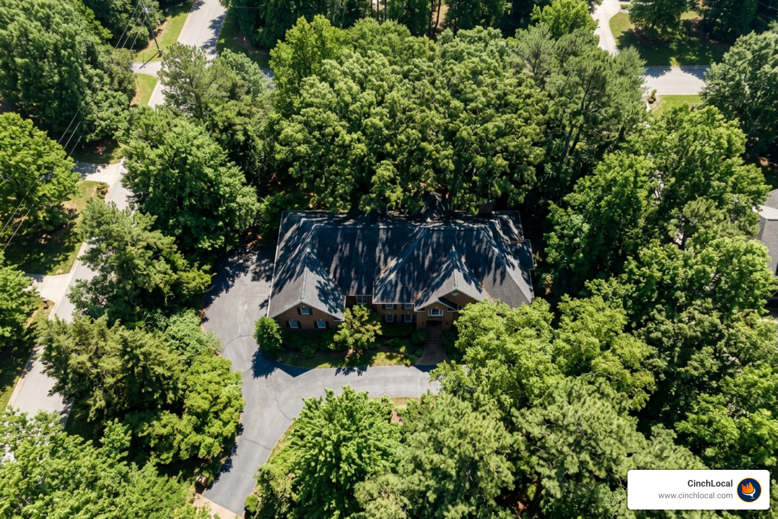
While digital measurements are fast, satellite mapping relies on overhead photography that carries physical limitations. Review Google Maps Roof Size Calculator: Measure Like a Pro from Your Couch and Calculate Square Footage Using Google Maps – Calculator City to understand precision parameters.
Identifying Camera Angle Distortion and Vegetation Obstructions
- Camera Angle Tilt: Satellite photos are rarely taken at a true 90-degree perpendicular angle. Off-center camera angles create projection tilt, skewing roof boundaries. To reduce error, trace foundation ground lines when roof edges are distorted by angle perspectives.
- Heavy Tree Canopies: Foliage overhang can hide eaves and valley intersections. Switch to historical satellite images taken during winter months when leaves have fallen.
- Shadow Masking: Dark roof surfaces or heavy tree shadows obscure ridge lines. Adjust monitor contrast or cross-reference 3D views in Google Earth Pro to identify hidden planes.
When Remote Estimates Are Safe vs When Field Verification Is Required
Remote satellite estimates are ideal for preliminary phone consultations, budget ballparks, and qualifying inbound leads. However, never order materials or sign a binding contract based solely on satellite measurements without field verification.
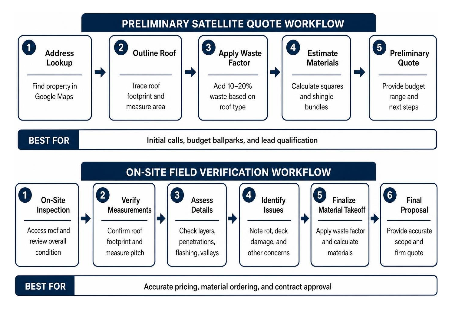
Perform an on-site inspection or drone measurement to verify:
- Exact pitch using a pitch gauge or smartphone level app.
- Multi-layer shingle teardowns.
- Hidden rot, sub-decking damage, and chimney flashing details.
Dominate Your Market with Local Search Visibility
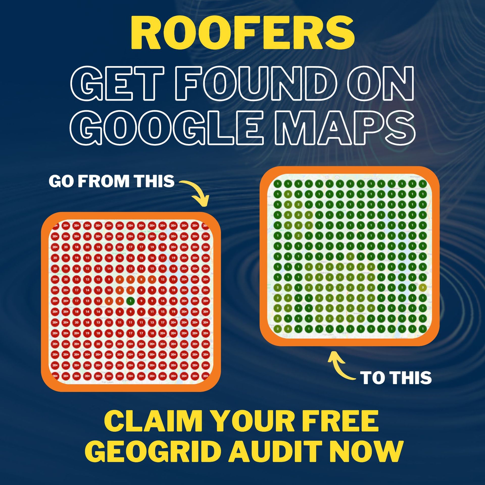
Accurate estimating is only half the battle—getting your business in front of ready-to-buy property owners is what drives growth. To scale your local online presence and generate pre-sold leads in your target markets, learn how our specialized Google Maps Local SEO for Roofers program drives steady inbound opportunities. You can also explore our proven results to see how we help roofing contractors expand their digital footprint and claim top map pack rankings.
Frequently Asked Questions About Satellite Roof Measurement
How accurate is Google Maps for calculating roof square footage?
Google Maps linear measurements are typically between 95% and 98% accurate under high-resolution satellite imagery. However, calculating overall roof square footage depends on applying the correct pitch multiplier and factoring in overhangs.
How do I convert Google Maps footprint area into roofing squares?
Multiply the flat 2D footprint square footage measured on Google Maps by your roof's pitch factor (e.g., 1.22 for a 6/12 pitch). Then, add a 10% to 15% waste factor allowance. Divide the final calculated total square footage by 100 to determine total roofing squares.
Can I issue a binding contractor quote using satellite measurements?
No. Satellite imagery measurements should be used strictly for preliminary ballpark estimates, material cost planning, and initial sales calls. Final binding contracts and material orders require on-site field verification to inspect deck conditions, eaves, and exact pitch details.
Conclusion: Turn Remote Roof Estimates into High-Converting Leads

Mastering google maps roof square footage calculations allows roofing contractors to estimate jobs faster, pre-qualify leads remotely, and operate a more efficient sales process. Combining 2D satellite footprints with pitch multipliers and waste additions gives you a strong preliminary estimate before setting foot on a ladder.
To build a streamlined estimating and lead-generation workflow, read The Definitive Guide to Using Google Maps for Roofing.
At CinchLocal, we help roofing contractors turn accurate remote estimating into predictable revenue. Our proprietary Roofer Footprint Expansion System is engineered to increase your Google Maps visibility and deliver pre-sold leads directly to your business.
Ready to dominate your local market and scale your roofing business? Contact CinchLocal today for a free strategy consultation and let's start growing your contractor footprint!
Want Us to Uncover Hidden 'Footprint Gaps' And Critical Blind Spots That’s Quietly Draining Calls, Jobs, and Profits?
Simply Fill Out The Form Below:
What If You Could Stop Wasting $30K+ a Year on Dead-End Marketing - And Finally Become the Go-To Roofer in Your City?
Other Helpful Articles You Might Enjoy